
A system of ankle-deep snow is poised to sneak into a highly populated part of Michigan
A storm system is set to emerge from the southwest United States, with its northern edge expected to penetrate the southern half of Lower Michigan.
Rain is expected to move through Michigan, with the heaviest precipitation staying just south of the state. However, in the northern part of the storm system, the rain may transition to snow on Friday. This band of snow will move from west to east across southern Lower Michigan.
The radar forecast for Friday morning to Friday evening is as follows.
Snow is expected to develop from Saginaw to Lansing late Friday morning. The forecast suggests that colder air will move down into the lower atmosphere, resulting in a change from rain to snow over a wider area during midday Friday. By noon, snowfall should be occurring from Saginaw to Lansing to Grand Rapids.
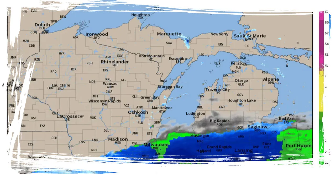
At noon on Friday, here is the current weather forecast.
Places like Ann Arbor, the Detroit area, Jackson, and Kalamazoo might not experience a complete transition to snow due to their warmer temperatures.
The snow from this initial snowfall is expected to taper off by 6 p.m. on Friday. It is worth noting that another round of light snow is expected to move through Illinois, Wisconsin, and Iowa late Friday night and Saturday morning.
The snowfall is expected to range from two to four inches in general, with isolated areas possibly receiving up to five inches. However, considering the potential for melting, it is more likely that the maximum snowfall will be around four inches. The majority of accumulations will be around two inches. The areas that will experience accumulating snow include Grand Rapids, Lansing, Saginaw, Bay City, Flint, and the Thumb. It is possible that the southern edge of the snowfall, as shown in the graphic above, could be slightly shifted towards the north.
As of 5:00 p.m. today, November 29, the snow band has not yet formed. It is possible that there may be some adjustments to this forecast. Stay tuned for an update tomorrow.
More News: