Storms are moving out of the area this evening as a cold front brings in colder air
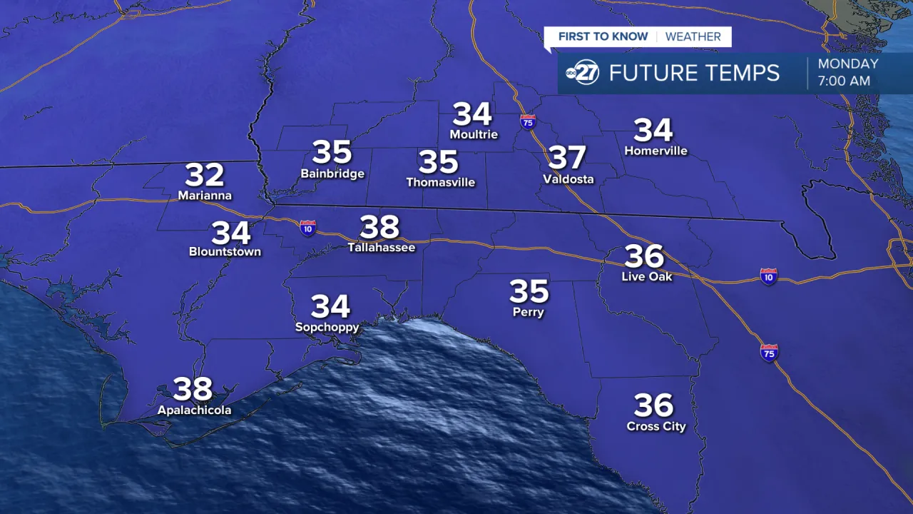
A severe thunderstorm and tornado warning was issued earlier this morning; the region is currently experiencing the departure of severe weather. Rainfall totals for today have ranged from 1-3 inches across much of the region, with isolated spots receiving up to 5 inches. Flooding has not been a major problem, but the rain will help portions of southern Georgia that are now experiencing a mild drought. Temperatures in the region are currently in the 60s, but overnight temperatures will soon drop into the 50s and into the 40s before midnight, and into the 30s in the early morning hours. Clear skies will accompany the lowering, allowing temperatures to fall as low as predicted.
Tomorrow will begin with bright sunshine that will last all day. Tomorrow morning, temperatures will struggle to rise above the 40s, with highs reaching the mid-50s by mid-afternoon. This is considerably cooler than our usual high of 67 degrees. The region will be dry for the first half of the week, with lows in the 30s and highs in the 50s on Tuesday. Wednesday will bring some milder air, but temperatures will remain below average, with lows in the low 40s and highs in the 60s.
Cloud cover continues to envelop the region as the week progresses toward the middle and end of the week. Temperatures will be milder due to mostly cloudy sky, with nighttime lows in the mid 40s and highs in the mid 60s. Rain possibilities increase as a low pressure system creeps into the region at the end of the week. This may bring the possibility of scattered showers and gloomy skies to the region during the weekend. You can put the umbrella away for the time being, but you could need it by the end of the week!
Read More:
- Breaking News: Quando Rondo, a rapper from Georgia, has been arrested on federal drug charges
- A missing kid was discovered safe after going into Georgia woods