
Expecting Chilly Weather and Possible Snow on Wednesday: The Alabama Weather Alert!
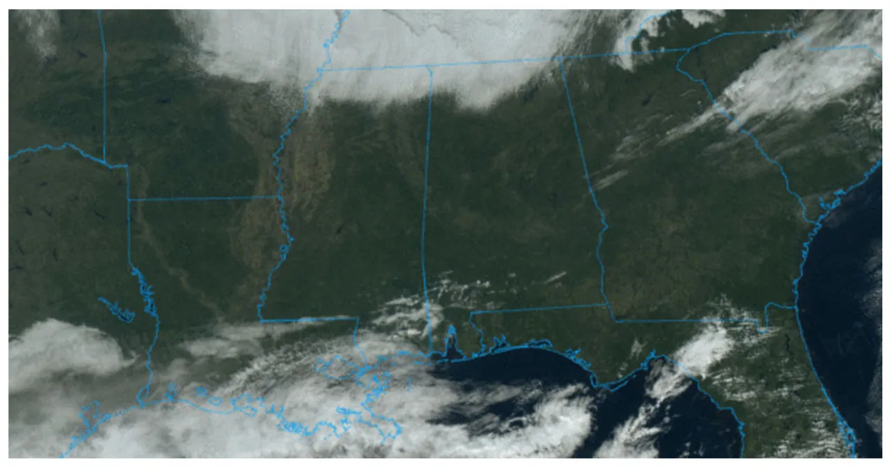
Most of Alabama is currently experiencing a sunny afternoon, except for the Tennessee Valley of North Alabama, where clouds are still present. The state is characterized by a significant contrast in temperatures, with Huntsville recording a chilly 39 degrees while Mobile enjoys a warmer 66 degrees at noon. As we move into the night, clear skies will prevail, but temperatures are expected to drop below freezing in most areas. Communities can anticipate lows in the 20s, extending as far as U.S. 80 from Demopolis to Selma to Montgomery to Opelika.
Tomorrow will bring another day of dry weather in Alabama, with plenty of sunshine. High temperatures are expected to range from 47 to 60 degrees across the state, from north to south.
Wednesday will see the arrival of a weak surface low in the northern Gulf of Mexico, resulting in cloudy skies and light rain throughout the Deep South. The southern two-thirds of Alabama, specifically from Hamilton to Cullman to Gadsden and points south, will experience the highest chance of rain. Initially, the air will be quite dry, leading to evaporative cooling that could potentially lower temperatures into the 30s across North/Central Alabama. Some high-resolution models even suggest a possibility of the light rain mixing with a few snowflakes in the afternoon or evening over the eastern and northeastern counties of the state. However, no accumulation or impact is expected as temperatures will remain above freezing.
Rainfall on Wednesday is expected to be less than 1/2 inch, with limited moisture. There is a possibility of thunder along the Gulf Coast, but there is no danger of severe storms due to the presence of a cool and stable airmass.
Thursday is expected to bring sunny weather to North Alabama, with temperatures reaching the upper 40s. In the southern regions, temperatures will range from the low to mid 50s. Moving on to Friday, it will remain dry with temperatures in the 50s. However, clouds will make a comeback on Friday night, accompanied by the possibility of some rainfall.
The upcoming weekend in Alabama will be marked by a dynamic weather system, bringing in a much-needed soaking rain on Saturday. It is anticipated that rainfall amounts will range from 1-2 inches. While there may be some thunder, the lack of surface-based instability means that severe storms are unlikely. Throughout the day on Saturday, temperatures will remain steady in the range of 50-55 degrees.
Sunday will bring the return of dry air, accompanied by a partly to mostly sunny sky. The temperatures will be mostly in the 50s, which is right around the average for early January.
Next week is expected to continue the active weather pattern, with the potential for another heavy rainfall event late Monday night into Tuesday (January 8-9). However, the latter half of the week is currently forecasted to be dry. Temperatures will remain near average throughout the week. For more information, including maps, graphics, and additional details, please refer to the video briefing.
 dummy
dummy
On January 1, 1964, a surprising turn of events unfolded for Bear Bryant’s eighth-ranked Alabama team as they prepared to face off against the sixth-ranked Ole Miss in the Sugar Bowl in New Orleans. Bryant had confidently stated that the only thing that could hinder their chances would be a freak snowstorm. However, to his dismay, a freak snowstorm did occur in the Crescent City the night before the game, covering the ground with an impressive 4 1/2 inches of snow. Despite the unexpected weather conditions, Alabama managed to secure a victory with a 12-7 margin.
The Deep South experienced a significant snowfall known as the “New Year’s Eve Snow,” which set a record in Alabama with an astonishing 19.2 inches in Muscle Shoals. Huntsville also received a substantial amount of snow, measuring at 17.1 inches. Northwest Alabama was particularly affected, with snow accumulation ranging from 15 to 17 inches, causing roofs and awnings to collapse. The snowfall caused widespread disruptions, with schools and businesses closing for up to three days. Furthermore, Meridian received 15 inches of snow, while Bay St. Louis MS saw over 10 inches. Mobile recorded two inches of snow, and Birmingham had a snowfall of 8.40 inches, ranking as the city’s fifth-largest snowstorm in history.
On this date in 2011, a series of severe storms struck southern and central Mississippi, resulting in the formation of 11 tornadoes. These tornadoes occurred during the night of December 31st and continued into the early morning hours of January 1st. Among the 11 tornadoes, two were classified as EF-3, indicating significant damage potential, while two were categorized as EF-2. Additionally, six tornadoes were classified as EF-1, and one tornado was classified as EF-0, indicating varying degrees of damage severity.
Don’t forget to check out the upcoming video briefing, which will be available here tomorrow morning at 6:00 a.m.
Read More:
- Fatal crash in Florida claims life of Alabama man and injures two others
- New information in the investigation into the relocation of the Space Command headquarters from Redstone Arsenal