

Latest Update on Alabama Weather: Light Rain/Snow Mix Expected Tonight Through Friday Night in Tennessee and Alabama
The upper level low is currently positioned near Indianapolis. As we speak, a powerful upper level disturbance is preparing to move across the Mississippi River from Arkansas. As a result of this disturbance, showers are being triggered across the northern portion of Arkansas and northeastern Oklahoma.
Rain and snow continue across the Midwest into the Great Lakes, to the north of the low pressure system.
According to the HRRR model, light rain showers are predicted to occur in Northwest Alabama by 6 p.m., as anticipated. At present, temperatures in the Tennessee Valley are in the mid-40s and will decrease to the mid to upper 30s in Northwest Alabama and the Valley, with the Northeast experiencing temperatures in the lower 30s.
Temperatures in the upper atmosphere will reach a point where the precipitation will transition into snow or mix with snowfall during the late hours of the night. This change is expected to occur primarily in the northern region of Alabama, with a particular focus on counties such as Jackson, Madison, Morgan, Marshall, Etowah, DeKalb, Cherokee, Calhoun, and Cleburne.
The HRRR for 4 a.m. CST Friday morning is as follows:
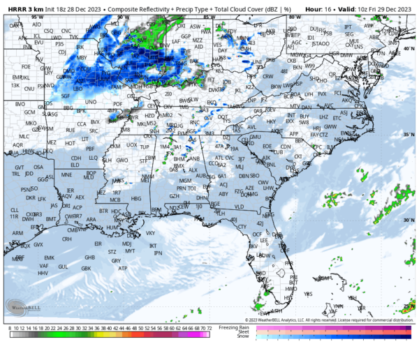
The National Weather Service (NWS) in Birmingham is warning residents in their northernmost counties, including NE Marion, Winston, Blount, northern St. Clair, Etowah, and northern Cherokee, that they could see up to a quarter inch of snow accumulation. There are even a few areas, such as northeastern Talladega, and northern Clay and Randolph counties, where patches of 1/4 inch accumulation are possible.
The NWS in Huntsville is not expecting any significant accumulations in their counties this afternoon, which is quite interesting.
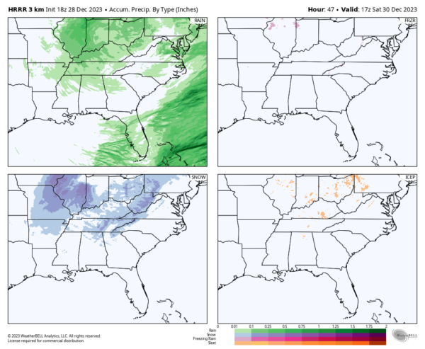
The HRRR model provides us with an updated 18z look at the accumulation of different types of precipitation.
 dummy
dummy
The National Weather Service (NWS) in Nashville recorded rainfall ranging from 1/4 to 3/4 of an inch in their eastern counties, with the highest amount observed in eastern Putnam County, northeastern Van Buren County, and Cumberland County near Crossville. Sam Shamburger, an exceptional forecaster from the NWS, who recently appeared on WeatherBrains, mentioned the potential need for winter weather advisories overnight on the Cumberland Plateau.
There is a possibility of light snow in southern Tennessee tomorrow night, which may affect Madison and Jackson counties in Alabama’s Tennessee Valley. Auburn fans planning to travel to Nashville for the Music City Bowl should stay updated with the latest forecasts to be aware of any potential road conditions caused by the snow.
I will closely monitor the situation throughout the evening and overnight hours to observe any potential developments.
Read More:
- Weather Alert: Watch for some snowflakes to arrive in Alabama soon
- Alabama Corrections Department reports that a murder suspect passes away in jail after “exhibiting erratic behavior.”