
What Are The Expected Impact of Hurricane Lee in New York City?
Hurricane Lee has been on the radar for nearly a week now, and for the past five days, the news headlines have been in a frenzy. Reports alleged that Hurricane Lee may threaten New York City or land in New Jersey. However, these claims were baseless then, and they still are today. The fact remains that Hurricane Lee will not come anywhere near New York City or New Jersey.
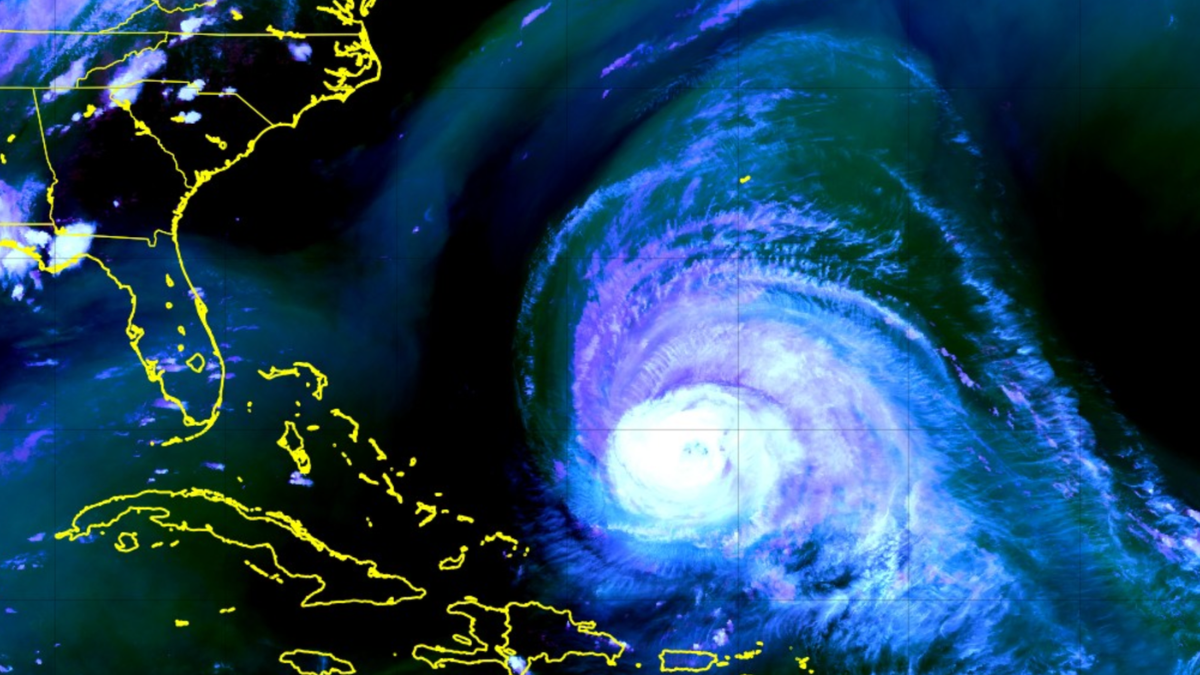
As of this morning, Lee remains a Category 3 hurricane, boasting maximum sustained winds of 115mph. The storm is expected to turn towards the north soon and gradually weaken as it approaches calmer waters. It will eventually interact with the mid-latitude jet stream later this week as it speeds northward.
By the end of this week, the storm is predicted to move several hundred miles east of New York City. While interacting with a mid-level disturbance on Saturday, it may briefly come closer to the New England coastline. However, it is still expected to remain far east of New York City. It is important to note that the showers and storms scheduled on Wednesday are unrelated to Lee and result from a different frontal system. Therefore, it is unlikely that New York City will experience any rain bands from Lee.
As Hurricane Lee continues its journey northward, its impact will be felt along the shores of the affected areas. It is common for storms of this magnitude to expand in size as they move towards their destination. The wind field of Lee is expected to become significantly more significant by the end of the week, resulting in rough seas and high surf/swells that could potentially affect areas several hundred miles away from the storm’s centre. This includes the beaches of New Jersey, New York, and Connecticut, where precautionary measures must be taken to ensure the safety of beachgoers.
As one moves towards the eastern and northern regions, the storm’s effects are expected to be more pronounced. This is particularly true for areas such as Eastern Long Island and Southern New England, where we cannot rule out the possibility of coastal flooding and beach erosion due to the rough seas. While some rain bands can reach Eastern Long Island or Eastern Connecticut on Saturday, heavy rain and strong winds are more likely to occur in Cape Cod and Eastern Massachusetts, New Hampshire, and Maine.
As Lee approaches New York City, the only indication of its proximity will be the cloud cover expected to envelop the region from Friday until the first half of Saturday. Despite this, the weather will remain pleasant with a decrease in dew points and calm conditions as Lee moves away from the area in the afternoon of Saturday.
As Lee demonstrates through another instance, it’s crucial to rely on credible sources for weather updates. One must bear in mind that numerous entities and individuals, particularly on social media, generate weather forecasts to garner clicks, views, and engagement, often causing panic and chaos.
In summary, Lee is expected to bypass New York City considerably far towards the east. While there might be some clouds due to the storm on Friday evening and Saturday, there is a chance that a few rain bands could reach Eastern Long Island. However, the primary effects of Lee’s movement through our region will be rough seas and high surf/swells.
Also Read:
- Niagara Metals scrapyard experiences a fire breaking out
- NYC Mayor Eric Adams’s proposal to cut overtime for migrants cost-cutting will lead to a wave of NYPD retirements.
- Gov. DeSantis and Florida Surgeon General Advises Against Getting New COVID Vaccine Booster Shot, Warns of Potential Risks